Weekend flyers
- Is Saturday flyable? The forecast matrix tells you at a glance.
- Your home airfield METAR right on the dashboard.
- Webcams show the real sky before you drive out to the field.


All features
Plan routes on a live map, see the multi-day forecast at every waypoint and follow where the weather is heading. Here is every feature at a glance.
14 days free · Cancel anytime
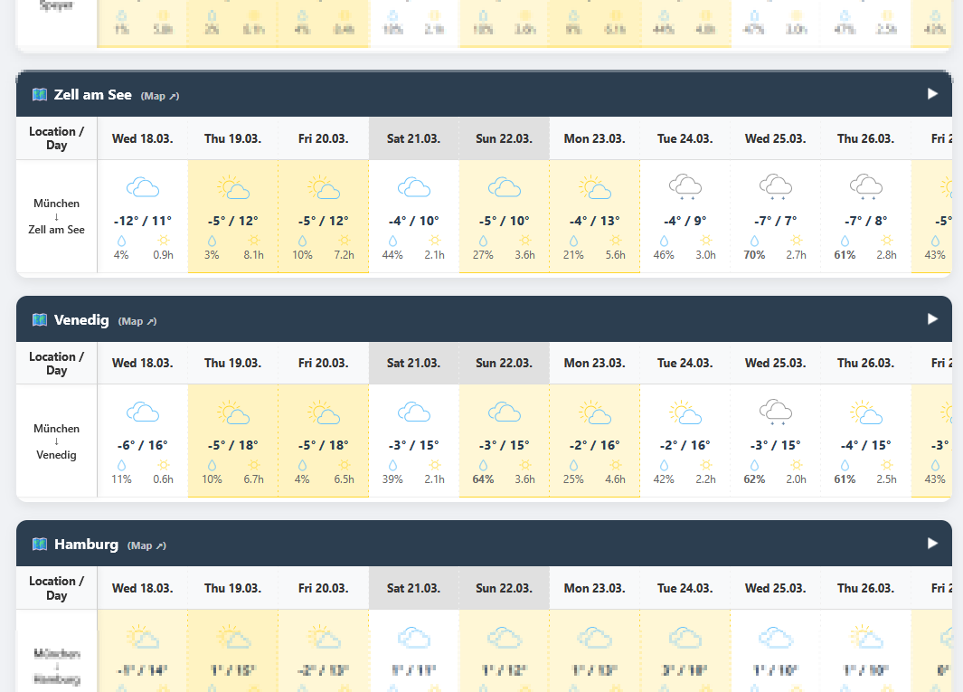
FlyVFR is a planning aid for VFR pilots: draw your route, see the multi-day forecast at every waypoint and keep an eye on live conditions along the way. It runs in your browser on any device and complements your official flight preparation.
ProIncluded with the Pro subscription. Everything else is free.
Weather on every route, the latest forecast on demand and every trend in detail, with FlyVFR Pro.
Subscribe to Pro now01 · Plan
Build anything from a local hop to a multi-day tour in a few clicks.
Set waypoints with a click on the map, reorder them by drag and drop and plan multi-day trips with overnight stops.
ICAO search, runway and elevation data. Closed fields are flagged right on the map.
Every new waypoint is named after the nearest airfield.
Find towns and landmarks by name, powered by OpenStreetMap.
Long legs are split into sections of at most 150 NM (adjustable), so the forecast covers the stretch in between too.
Bring routes from other planning tools straight into FlyVFR.
02 · Forecast
Up to seven days ahead, read for the day you will actually be at each stop.
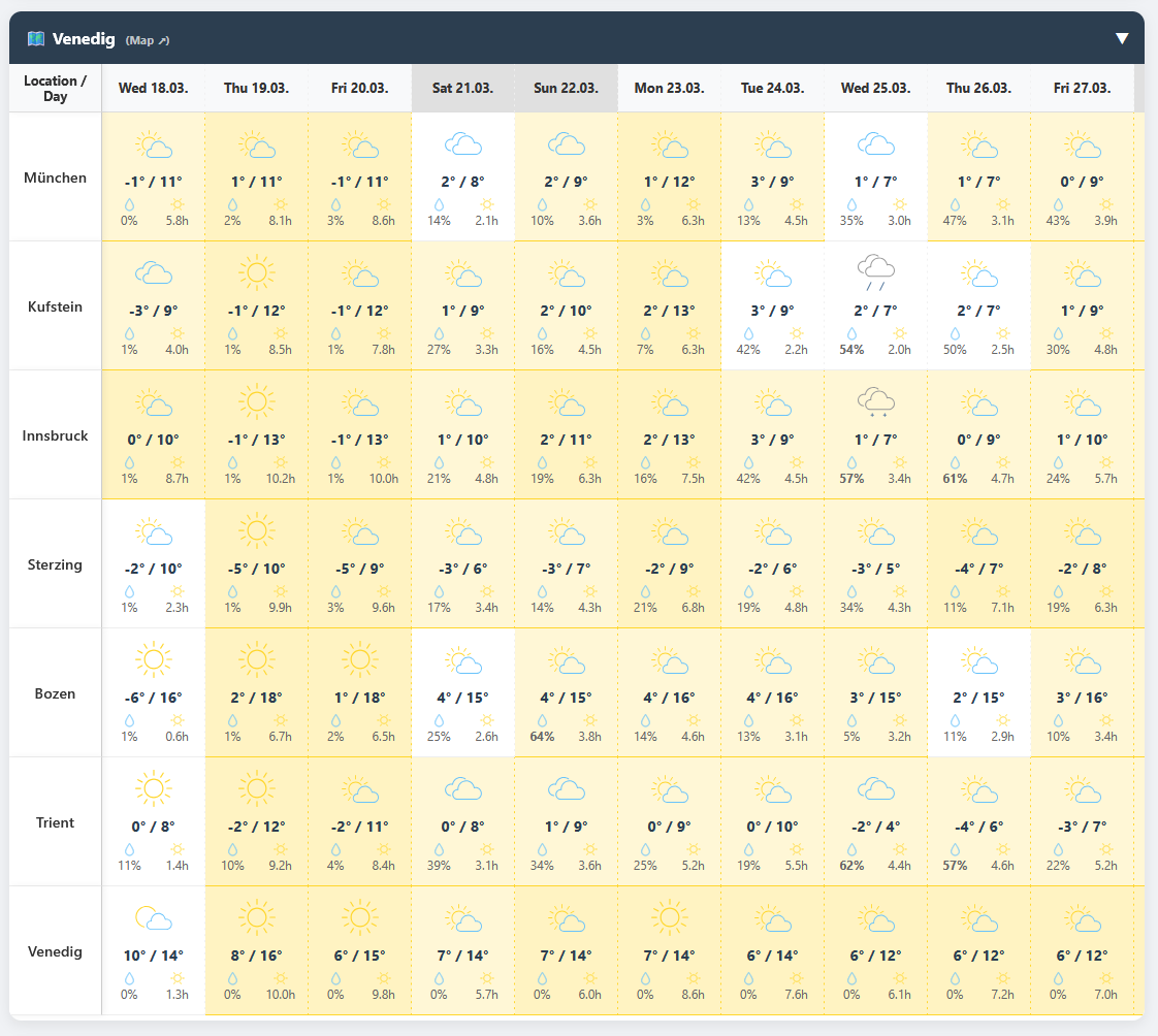
Temperature, rain and rain probability, sunshine, wind and gusts for every waypoint, with critical values in red.
One row shows the worst conditions along the entire route for each day, overnight stops included.
DWD data via Bright Sky for Germany, or Open-Meteo worldwide.
Forecasts older than an hour are refreshed in the background as soon as you open your dashboard.
Free accounts get the forecast on their first two routes. With Pro you see it on all of them.
Pull the latest model run whenever you like. Your refreshed data stays private to you.
03 · Monitor
Real observations instead of guesswork, right on the map.
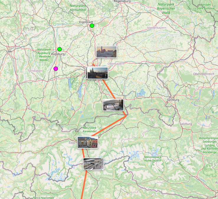
Along your route, colour-coded by flight category (VFR / MVFR / IFR / LIFR).
If your field issues no METAR, FlyVFR picks the nearest reporting station within 150 km.
foto-webcam.eu, Windy and the airfields' own cameras. See the sky before you launch.
Calculated per runway, so you know your limits before you commit.
Shows every station, camera and airfield within range of your route.
04 · Trend
Is your weekend trip getting better or worse? Focus a route and watch every new forecast run.
Pin one route and FlyVFR records its forecast four times a day, for up to 30 days.
A score and trend arrow for each departure day, on every account.
Temperature, rain, sunshine, wind and gusts each as their own trend, from a start date you choose.
Weather on every route, on-demand refresh, route import and detailed weather trends: all included in Pro.
Subscribe to Pro now14 days free · Cancel anytime